The UN General Assembly has voted to replace the traditional Mercator world map, which drastically shrinks Africa’s size.
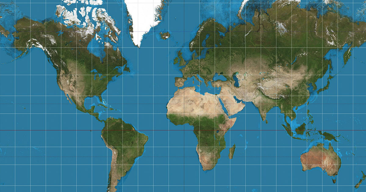
For hundreds of years, most of the world has looked at maps that make Africa appear roughly the size of Greenland when in reality, Africa is about 14 times larger.
The General Assembly passed a resolution called “Correct the Map,” sponsored by Togo and backed by African Union member states. It picked up support from 164 countries, including France and the UK.
The US was the only country to vote against it, and six nations abstained.
The vote itself is non-binding, but it’s expected to influence how maps are used across institutions worldwide.
Why the old map is so wrong to begin with
The map most people grew up with, known as the Mercator projection, was created back in 1569 by Flemish cartographer Gerardus Mercato to help European sailors navigate. However, it’s impossible to flatten a globe onto a two-dimensional surface without some kind of distortion.
Mercator’s version compensates for the earth’s curve by making countries near the equator look smaller than they actually are, while countries closer to the poles get stretched out and appear larger than reality.
A more accurate alternative
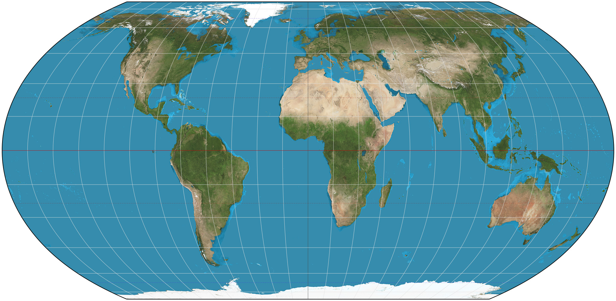
In 2018, a team of cartographers introduced something called the Equal Earth projection, designed to represent land area proportionally. The African Union officially adopted it back in February, saying it does a far better job representing the true size of every continent, especially Africa.
As the campaign group behind the push, #CorrectTheMap, put it: “You could fit the United States, China, India, Japan, Mexico and much of Europe into Africa and still have land to spare.”
Not just about geography
Togolese Foreign Minister Robert Dussey framed the issue as something bigger than lines on a page. “A fair world begins with a fair map,” he told Reuters.
French Foreign Minister Jean-Noël Barrot backed this sentiment, confirming his ministry would stop using the Mercator map altogether.
“Changing the map obviously doesn’t change the world,” he said, “but correcting a representation that distorts it is already an act of truth.”
“Africa’s misrepresentation on world maps is not just a cartographic error, it’s a narrative issue,” said Lerato Mogoatlhe of Africa No Filter, one of the groups involved in the push.
Kenyan geographer Kioko Muendo noted how a continent is drawn can shape how it’s understood economically and politically. “Maps are more than just guides for travellers,” he said. “They shape how regions are perceived politically and economically.”
Why the US representative pushed back
Not everyone agreed the issue deserved UN attention. Yaryna Ferencevych, a US representative at the UN, argued the resolution distracted from more pressing global concerns.
“Instead of focusing on genuine problems of international peace, prosperity, or good relations, this body is debating map projects from the 16th Century, and their role in promoting reparations and ‘cognitive justice,'” she said.
This isn’t the first time the US has pushed back on a resolution tied to historical injustice, as recently as in March this year the US criticized a separate UN resolution that formally declared the transatlantic slave trade “the gravest crime against humanity.”
READ MORE:
- Court documents reveal chilling four-word comment Lindsay Clancy made while killing her children
- Hayden Panettiere’s neighbor describes horrific scene inside apartment block after she had an apparent overdose